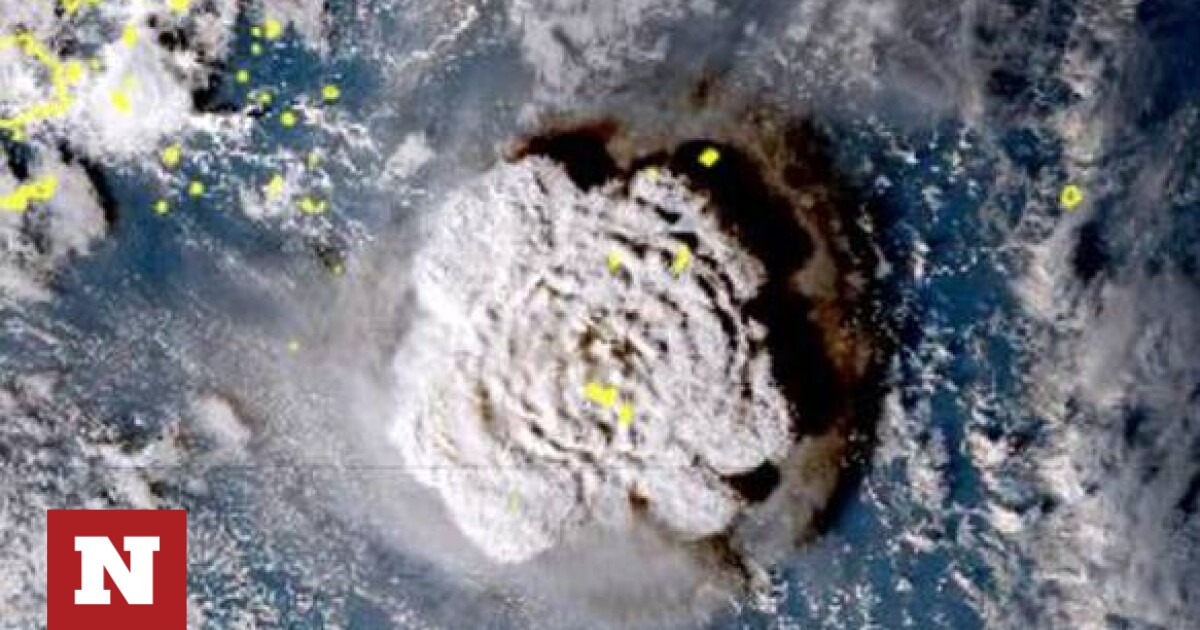
Sakis Arnoutoglu: What can be caused by the unusually large amounts of water vapor emitted
Can The eruption of the Hunga Tonga volcano To change the weather next winter? In particular, in his post with a source from wetteronline.de, he says:
“On January 15, 2022, the most powerful volcanic eruption in modern history, the Hong Tonga volcano, released massive amounts of water vapor into the stratosphere. Some researchers believe this may disrupt the wind currents that drive the weather here in the coming winter.
A group of researchers from the California Institute of Technology (USA) showed that the massive eruption in January can affect the Earth’s climate as well. Because very little sulfur dioxide was released during the eruption, they hypothesized that the typical cooling effect of large volcanic eruptions could not be effective.
Conversely, unusually large amounts of water vapor emitted can cause the opposite effect. This is due to the fact that water vapor is a very powerful greenhouse gas, the increase of which inevitably leads to an increase in the temperature of the lower layers of the atmosphere in the medium term.
Moreover, in the upper part of the dry stratosphere, measurable cooling is expected. And this is exactly what the researchers were able to establish, the beginning of a large-scale cooling of the upper stratosphere over the Southern Hemisphere.
Meanwhile, this cooling in the stratosphere has taken on an unprecedented magnitude and this phenomenon is also expected to extend to the Northern Hemisphere over the coming months.
A meteorologist from Severe Weather Europe has now investigated the question of the effects that these processes can have on the temperatures and flow patterns of the main wind patterns that define weather in the Northern Hemisphere.
Based on a very complex series of evidence, it was concluded that the expected thermal deviations could also influence the behavior of the so-called North Atlantic Oscillation (NAO) and strengthen the tendency towards the formation of a negative NAO index.
This means that the pressure difference between the bottom of Iceland and the high of the Azores will weaken, creating more favorable conditions for cold incursions from the Arctic over most of Europe!
Since the eruption of the Hong Tonga undersea volcano is a phenomenon with many special characteristics that have not been observed on this scale before, any conclusions drawn from this event must be evaluated with extreme caution!!!
For example, a high pressure system (Anticyclone) blocking signals from the Atlantic might result in very mild winter weather over much of Europe if it were well established over southeastern Europe rather than the British Isles. In addition, the expected effects on the NAO could be absent or delayed until spring, so that winters are more “Atlantic type”, i.e. mild and wet.
In short: seasonal forecasting research is important and good. However, this research is still in its infancy and can only provide preliminary indications. Therefore, it should never be confused with forecasts that are actually achievable for the next few days, which, thanks to the progress of modern meteorology, are considered largely safe.
Therefore, even based on the still very sparse results of the Tonga eruption, the question of the upcoming winter is still open. As always, we will know for sure only at the end of winter, in March».

“Hipster-friendly coffee fanatic. Subtly charming bacon advocate. Friend of animals everywhere.”


More Stories
F-16 crashes in Ukraine – pilot dies due to his own error
Namibia plans to kill more than 700 wild animals to feed starving population
Endurance test for EU-Turkey relations and Ankara with Greece and Cyprus